Spokane River Watersheds
Watershed Planning & Implementation for WRIAs 54, 55, 56, & 57
WRIA 55 Data-Lower Sand & Gravel Aquifer
 WRIA 55 Web Mapping Application
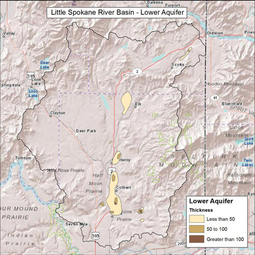
This unit consists of localized confined aquifers consisting of sand and some gravel that occurs at depth in various places in the basin but appears to be fairly continuous at depth below the lower reaches of the Little Spokane River. The unit is overlain by the Upper confining unit and underlain by other low-permeability sedimentary units (Lower confining unit, Latah unit), basalt, or bedrock.
WRIA 55 Lower aquifer extent and thickness. Delineated in USGS Scientific Investigations Report 2013-5124.